Automation of vehicles in port environments
The automation of vehicles in port environments is one of the key elements of modern logistics, enabling smarter and more connected ports in a context of growing global demand and pressure for sustainability. This content is an adapted and summarised version of the paper ‘Collaborative Localisation and Perception in Port Scenarios: CleanPorts 5.0’ presented at the 16th European Congress for Leaders in Smart Mobility and Intelligent Transport Systems.
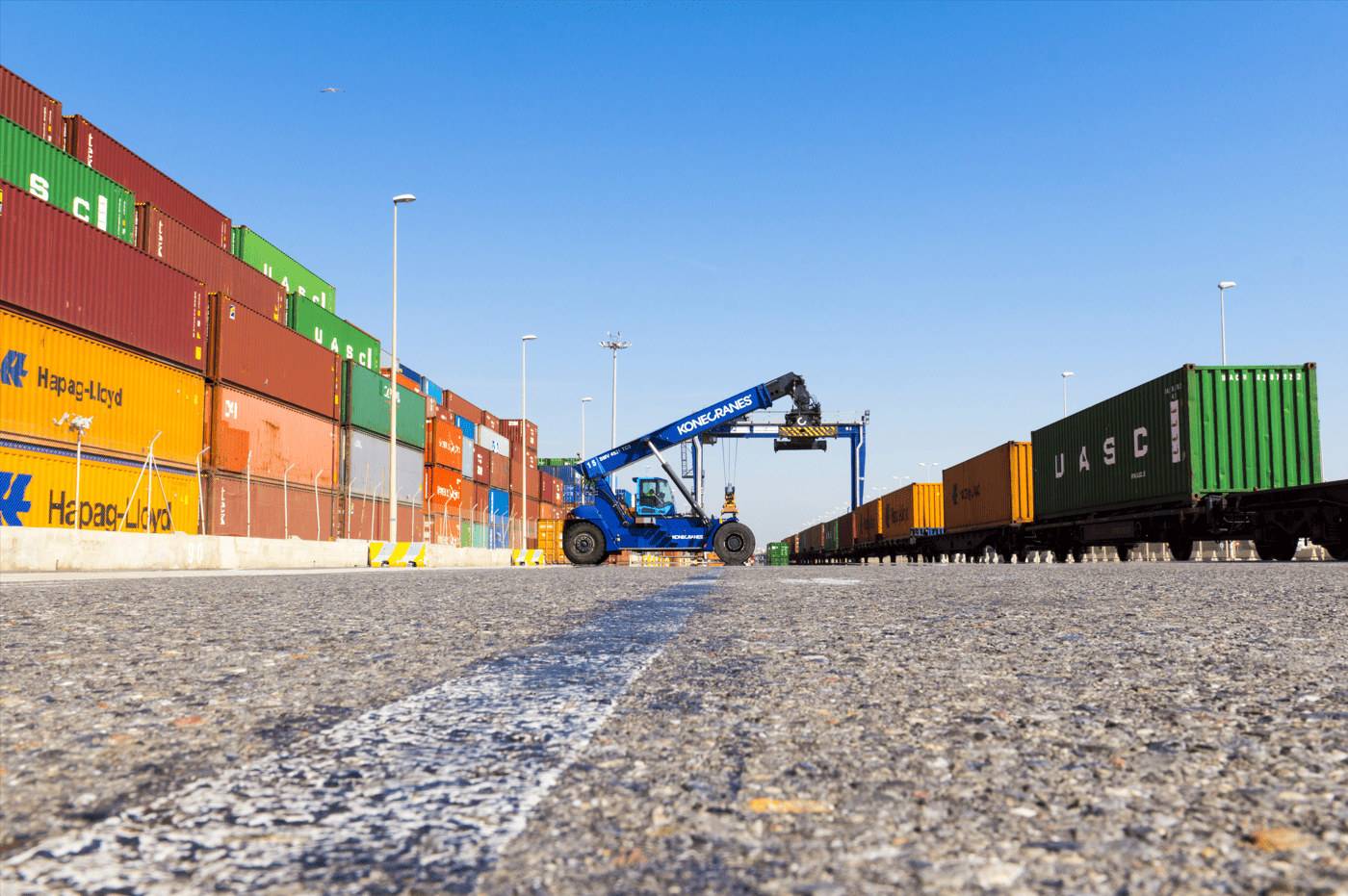
Ports are key hubs for global trade, handling approximately 75% of internationally traded goods. These environments are home to numerous vehicles—container trucks, autonomous guided vehicles (AGVs) and other specialised equipment—which must operate in a coordinated manner in often confined spaces with high traffic density.
However, navigating and locating these vehicles is not always easy. Traditional GNSS-based systems (such as GPS) can lose accuracy in port terminals due to the presence of large cranes, metal structures and stacks of containers, which cause signal interference.
In this context, having more advanced location and perception systems is essential to ensure safe and efficient operations. One of the emerging solutions is infrastructure-based perception, where sensors installed in the port itself monitor the environment and provide a global view of what is happening in the terminal.
This approach complements the systems installed in vehicles, improving obstacle detection, facilitating traffic coordination and reducing the risk of collisions. In short, it enables progress towards safer, more efficient port operations that are ready for automation.
In port environments, there are three main challenges that this research seeks to address:
- Interference with positioning signals: Large metal structures, cranes and stacks of containers can interfere with satellite positioning signals (GNSS), reducing their accuracy.
- Traffic complexity: High-density traffic requires precise obstacle detection and avoidance capabilities.
- Cooperation requirements: vehicles and infrastructure must share information to improve situational awareness and safety.
The dynamic nature of port environments, where the position of containers changes frequently and a large number of vehicles circulate, limits the use of simultaneous localisation and mapping (SLAM) techniques, which tend to work better in more stable environments. In this context, LiDAR odometry (LiO) emerges as an effective alternative, as it focuses on estimating the position of the vehicle without the need to generate a complete global map. This makes it particularly suitable for dynamic environments with few fixed references, such as ports, where the main objective is to ensure accurate localisation.
LiDAR odometry allows the position and orientation of a vehicle to be estimated by analysing consecutive LiDAR scans. This system can operate independently or be combined with other sensors, such as inertial measurement units (IMUs), which record accelerations and angular movements at high frequency. This combination helps to reduce distortions in LiDAR scans caused by vehicle movement.
This study uses DLIO (Direct LiDAR-Inertial Odometry), an advanced solution that combines LiDAR and inertial data to improve vehicle trajectory estimation with lower computational load. The system is complemented by RTK-GNSS, which provides accurate initial positioning, while DLIO allows for continuous and more robust location tracking even in areas where the GNSS signal is degraded.
To evaluate this approach, infrastructure-based perception is implemented in the CARLA simulator, using a LiDAR sensor located at a fixed point on the infrastructure within a simulated port area. The environment reproduces a port scenario with multiple vehicles, including lorries and cars, travelling along different routes.
Based on the data captured by LiDAR, the PointPillars model is applied, a deep learning-based 3D object detection system designed to process LiDAR point clouds quickly and efficiently. Subsequently, a real-time tracking algorithm (SORT) is used to maintain the identification of each vehicle over time, allowing continuous tracking of moving vehicles. The LiDAR installed in the infrastructure thus provides a comprehensive view of the environment, capable of detecting and monitoring multiple vehicles simultaneously.
This approach demonstrates the potential of combining on-board perception and infrastructure-based perception to facilitate autonomous navigation in port environments, improving safety, traffic coordination and operational efficiency. Furthermore, such solutions could also be applied to other industrial environments characterised by high vehicle density.
References
- Justo, A.; Murgoitio, J.; Soler, A.; Palomo, P.; Martín, Á. (2025). Collaborative Localization and Perception in Port Scenarios: CleanPorts 5.0. 16th ITS European Congress, Seville, Spain, 19–21 May 2025.
*Disclaimer: This English version has been generated with the support of AI-based translation tools. In case of discrepancies, the Spanish original prevails.